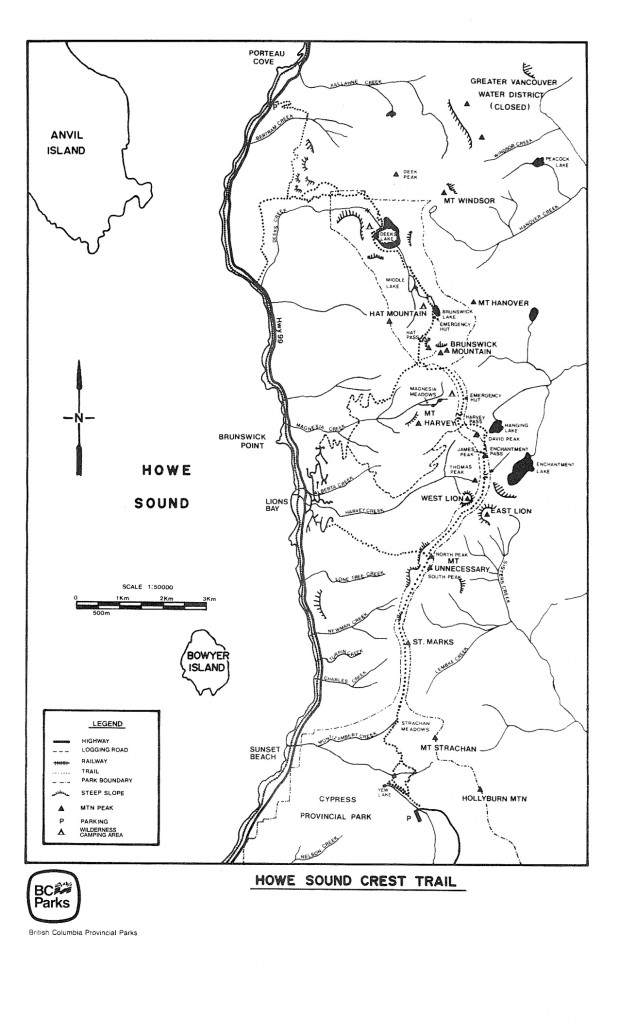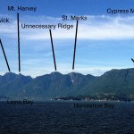
The route begins at the base lodge of Cypress Mountain Resort and takes a well maintained path around Mt. Strachan before climbing up and over St. Marks and Unnecessary summits. Past Unnecessary, the trail becomes much more rough as it passes by the well travelled West Lion trail from Lion’s Bay. Beyond the Lions, the trail is steep, rough and overgrown as you pass or climb over Thomas, David, and James peaks before climbing up to the emergency hut at Magnesia Meadows between Harvey and Brunswick Peaks. A short flat section takes you to Hat Pass and the beginning of a long descent down past Deek’s Lake into Porteau Cove on the Sea to Sky Highway.
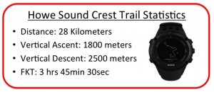 At the end of July, Nick Elson and I had a crack at the trail, setting an FKT of 3hrs 51min on a hot day. We hoped our record would stand for a little while but six days later, Gary Robbins made his successful attempt. Gary is an accomplished ultra runner and race director of the Squamish50 Ultra Marathon coming up in a few weeks. Gary also spent his first season training for ski mountaineering this year with us, racing at the Alpental Vertfest in February.
Mountain runs like the HSCT are excellent training for skimo. Between three and four hours of running is similar to a skimo race. The trail requires a mix of running and power hiking as well as significant downhill running that will help contribute to leg strength for the winter.
Here is a quick interview with Gary about his run (and a few notes by me):
 Q: What made you decide to go for the record?
I have run the HSCT five times now but always with a group of friends. I’d always wondered how fast I could get through that terrain and had intended to do so at some point this summer. It was coincidental that it happened less than a week after Eric and Nick’s run and their time certainly kept me honest out there..
Q: How much of the route were you able to run?
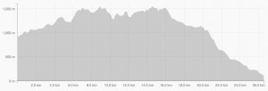
I was able to run 90% of the descents and about 60% of the climbs. There are some overgrown sections that prevent the ability to run but outside of that whatever grade was runable I managed to force myself to run.
Q: What makes the HSCT a good route to try for an FKT?
It’s just a classic local route and stunningly beautiful. There are lots of contrived FKTs out there these days, but the HSCT is as pure as it gets, full point to point, no senseless deviations, and linking together some of the best terrain in the lower mainland.
 Q: What was the hardest part of the day?
The climb up on and over Mt. Unnecessary was a definite low point where I was staring to feel the effort. (I found the section climbing up to the Harvey-Brunswick Col and Magnesia Meadows to be the most difficult. The trail would be runable if it weren’t so overgrown with low bushes. Even worse, the bushes are only knee to hip height so provide no respite from the sun that was beating down hard. We were also running low on water at this point.)
Q: What was the best part of the day?
Going over St. Mark’s Summit first thing in the morning, 34 minutes into my run and knowing that I was on FKT pace and feeling like I was about to have a very special day. The views from up there always make not stopping and taking it all in a bit of a crime.
Q: Hint for someone looking to run the route in a day?
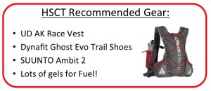
There is next to no water out there, be prepared and carry ample food and fluids. There are two backcountry huts on the route, both near water sources, other than that there’s nothing else to be had.
(This is very true. We carried enough water to be self sufficient until the Magnesia Meadows Hut where we refilled. After starting the descent from Hat Pass, you cross several streams and creeks and carrying water is no longer necessary.)
