Spring conditions, longer days and good friends make for amazing multi-day trips. And since we are in that time of the year here is an inspirational interview with one of the greatest Canadian adventurers. Enjoy!
Many people have big goals or great plans but somewhere along the way they get side-tracked and they steer away from their dreams, even though they were completely obsessed with them before.
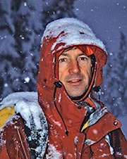
I don’t know John Baldwin well enough to categorize him within the two groups, however, I know John well enough to draw great amounts of inspiration either from him as a person, from his guide books or simply from hearing his name from other people.
John Baldwin is a ski touring explorer and a photographer that over the past 30 years pioneered the biggest traverses in the most remote areas that can still be reached by foot. Living in Vancouver, BC he dedicated himself to explore the Coast Mountains of western BC to great extent and detail.
One year ago John released a third edition of his guide book – Exploring the Coast Mountains on Skis – where he was finally able to complete the publication with trips over the full length of this almost 1500km heavily glaciated mountain range.
I and many other ski tourers can’t now even imagine to do a traverse on the west coast without referring to John’s book on a daily basis.
John Baldwin shares his adventurers and offers some advice
Q: You are dedicated to explore the Coast Mountains. Why this mountain range?
I grew up in Burnaby and Vancouver. I used to stare up at the mountains and wonder what was behind them. What I discovered was this incredible mountain wilderness that stretches for 1500km. And I’m continually drawn back!
Q: How do you pick your new destinations? Is there a master-plan and you just go down the list?
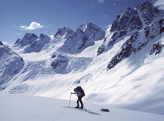
Sometimes you see a peak or a run or an area you’d like to check out or you get an idea for a route or ridge that might connect.
For local trips, I also get ideas from guidebooks (including mine!), friends and trip reports too.
And ski mountaineering depends a lot on weather, snow and avalanche conditions so I like to have a bunch of trip ideas on hand and then pick the one that suits the conditions best.
Many trips are best at certain times of the year and that definitely comes into it as well.
Q: To travel to new places, through new mountains, requires long trips. What time of the year do you do your traverses? How long do they usually take?
Most of my long trips to remote icefields and high glaciated summits are in May. I love winter for full on snow but spring is definitely best for longer trips to high alpine areas.
Weather and avalanche conditions are generally better. Long spring trips are anywhere from 2-4 weeks but most are about 3 weeks.
Q: The best thing about your travels is that you are sharing them with others through your guide books. Do you feel a certain duty to share information about new places for others’ enjoyment, or is it just a natural progression because you keep detailed records about your trips anyways?
I’m constantly blown away by how beautiful the Coast Mountains are and by the incredible opportunities we have to ski in such an amazing place.
I want to share that with other people and turn them onto what we have here, either through pictures or through trips they might do.
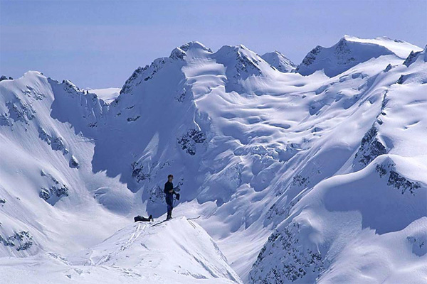
My guidebook covers the entire Coast Mountains, which stretch north from Vancouver for 1500km to Skagway, Alaska.
Two thirds of the book focuses on trips in the south-west corner of British Columbia, the rest covers the more remote areas all the way up the coast.
Q: You have telemark skied all your traverses. Now, you are also starting to use light alpine touring gear for backcountry skiing. Which one do you find more suitable for long traverses and why? Which things should one consider before he chooses the right setup if he wants to start doing long traverses?
I don’t have strong preferences on recommending gear. I have used all sorts of gear over the years. I started on xc skis in 1972. I used AT gear in the mid 70s, then lots of different types of gradually improving tele gear over the years.
Last year I started using Dynafit bindings. I’ve seen people do everything from gentle tours to steep descents on gear ranging from tele bindings to Dynafits, Fritchies with big stiff boots and even split boards.
I think the reason there is a lot of good gear out there is because of all these different influences. There is a lot of crossover that leads to new ideas and better gear.
Q: What do you use for navigation on traverses in new areas?
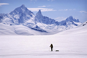
I only use a GPS in bad weather, when they can be really helpful – but don’t forget they don’t help you see crevasses and other hazards!
Q: Were there always topo maps you could get your hands on or did you even do trips where you basically were drawing the map?
The 1:50,000 maps were all finished in the 1970s and that is what I have used for all my trips. They are generally very good, but it’s still a big jump to what the terrain actually looks like. For example, rock bands and heavily crevassed areas don’t show up.
For some trips I would try and check government air photos as well. Now there is Google Earth, which is generally very helpful (though in some areas with low res its hard to see crevasses).
Q: I noticed you don’t use watches when backcountry skiing. Do you use them on multi-day trips? Do you use an altimeter?
It’s great to know when it’s lunchtime and for a long day trip it’s helpful to set a turn around time. But I don’t find knowing the time to be that important when you are on a longer trip (though my friends usually have a watch!).
You develop a sense of the time and you can always look at the sun. I always mean to bring a watch but usually forget.
Altimeter watches are very useful for watching pressure changes in the weather. Occasionally, they come in handy for navigating too.
Q: Do you carry a satellite phone or something else for communication with the world while on a ski traverse?
Yes, but we only use them for emergency purposes. Before there were sat phones we would carry and ELT (Emergency Locator Transmitter) on some long trips.
Q: Do you use food caches on your traverses or do you carry everything yourself from the beginning?
Both, depending on the trip.
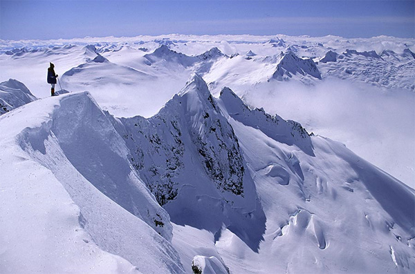
I went to UBC (University of British Columbia) and learned a lot in the Varsity Outdoor Club. There were no courses of any kind back then so the club would organize lectures and ski schools etc.
More experienced members or other people like Peter Schaerer or Frank Baumann would come and give lectures on avalanches, first aid, backcountry skiing and all sorts of topics. The rest I learnt from experience, and trial and error with my friends.
In terms of exploring – I think I learnt that from my father. He wasn’t a mountaineer but he always had an interest and curiosity in the world and life. To me exploring is not really about goals, it’s sort of like following the scent of something to see what it turns out to be.
Q: Where is your next trip planned?
The Coast Mountains of course! My next long trip is in May to the Lillooet Icefield. It will be 30th anniversary of my first ski trip there.
Q: Where would you want to go skiing anywhere outside of Coast Mountains?
I’ve skied in the Rockies, Selkirks, Kootenays and St Elias Mountains over the years. One place I would to like ski that I never have is at Rogers Pass.
Q: Please recommend 3 traverses that would be good introduction for people that have never done any before.
There are so many different kinds of trips at different times of the year and for different conditions. On page 18 of my book I try to give some recommendations for everything from easy day trips to big descents and long traverses.
For traverses it’s hard to pick out just three, but here it goes:
- Garibaldi Neve Traverse (page 60) This is probably the best introduction to a traverse in the Coast Mountains. It is not too difficult yet gets you up high on big glaciers in the wilderness of Garibaldi Park. It was my first traverse and gives you a glimpse of a whole other world out there.
- Spearheads Traverse (page 79) This the classic trip in the Coast Mountains. 1-4 days. All alpine. 12 glaciers. Tons of peaks and great ski runs.
- Misty Icefield Traverse (page 65) I put this one in because it’s a great introduction to a longer trip (about 8 days). You are closer to Vancouver than Squamish yet you are way back in Garibaldi Park in the middle of nowhere. You won’t see anybody for a week and the whole thing is a big adventure.
Q: What band or genre of music would you choose to listen to if you had to be stranded in a tent for a week?
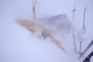
Next time you are stuck in the city on a rainy day, imagine what it’s like way up on some icefield with 1m of new snow and the wind howling across the glaciers, buffeting against your tent.
To be fair, a week is long time! I do often bring a book along to read.
Ski hard when it’s sunny, so you can sleep when it’s stormy…
More about John and his projects
To learn more about John, his adventures or to buy his guidebook check out his website at www.johnbaldwin.ca.
Once there, make sure to check out John’s photo gallery. It contains amazing shots from wild places from the whole Coast Mountains range… and way more…


Lou says
Thanks John
For your excellent book. I may see you on the Illooet Ice-field this may.. I’ll be the guy hanging out at 9000 feet at the center of all the glaciers.
Paul Cardosi says
Thanks for your time and effort to share this information. It makes me want to head right to the box of maps to start planning…
Reiner says
Great interview guys really inspiring thanks for sharing!
Gatier says
Thanks Stano (and John), interesting interview. I can’t wait to be stuck in the tent in a storm again :-)))